20+ Amazing Historical Photos of Calgary, Alberta
- July 12, 2024
- By Cody Battershill
20 Historical Photos of Calgary You'll Love!

Downtown Calgary Looking Northwest - Early 1900s
If you’ve been to Europe or Asia, chances are you’ve seen some structures that are hundreds, if not thousands of years old. In Calgary's case, the oldest buildings were constructed in the early 1900s unless you head to Fort Calgary, that is.
All of Calgary’s historic buildings have an incredible story to tell, even if they aren’t that ancient. Today, many of these structures that are still standing have been designated as heritage buildings by the City, enjoying special treatment and undergoing frequent testing and restorations to make sure they’re in good shape.
If you live in Calgary, you’ve probably seen some of these buildings around and may not have even known it! As you’ll see in the photos below, these structures were part of an ever-changing story that has unfolded and developed over many, many years into the Calgary we live in today.
Here are several historical pictures of Calgary, Alberta, that will make you think about how life was way back then for locals, and just how different our city was over the past several decades as it has grown to more than 1.4 million people as of 2024.
- Calgary Districts: Map & Community Guide
- Best Patios in Calgary: 32 Patio Restaurants You'll Love
- New Communities Coming to Calgary
American Hill - Early to Mid-1900s
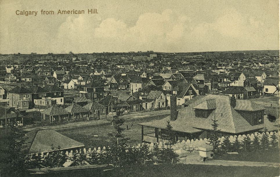
American Hill was originally an enclave for American-born business elites. Later on in Calgary’s history, this area was renamed Mount Royal which today consists of Lower Mount Royal and Upper Mount Royal, the latter of which being one of the most luxurious communities in the city.
It looks like this photo was taken from Lower Mount Royal as the land in front is somewhat flat. This is about where 17th Avenue SW would be today we're guessing.
Fort Calgary – 1880s
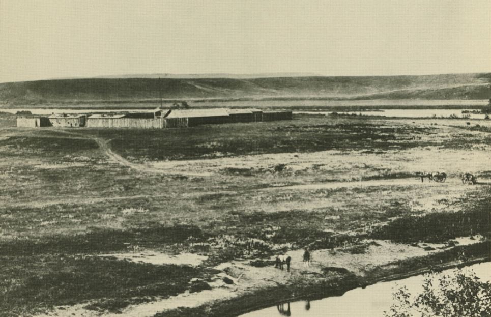
Here is Fort Calgary in all its original prime and glory in the 1880s. Behind it, to the north, you can see the Bow River, while further north you can see where the communities of Sunnyside, Crescent Heights and Briar Hill / Hounsfeld Heights exist today and the popular plateau of the north inner city that overlooks the downtown skyline.
In the far distance, you can faintly see a huge hill that would one day be named after its aerial shape (Nose Hill Park). On the bottom right you can also see someone doing something along the embankment of the Elbow River.
Tent Town in the Early 20th Century
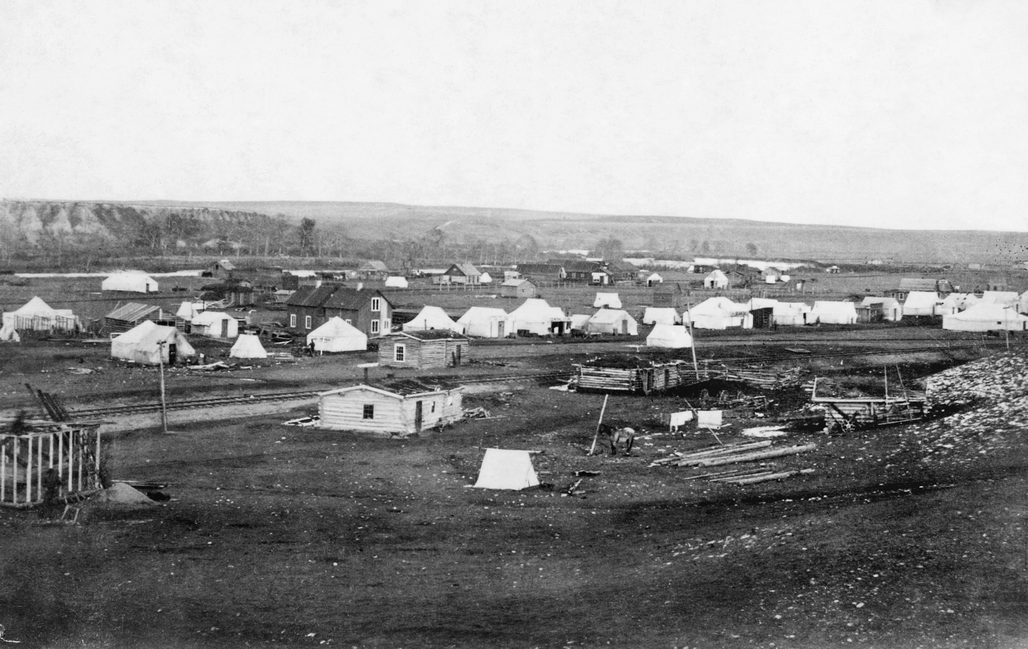
Calgary’s tent town existed in the downtown area in the early 20th century. The city had quite the reputation as a party town with all the fun available that you could imagine.
Tents weren't uncommon in Calgary in the early days. They provided settlers with temporary and permanent housing and were used by businesses as storefronts.
Downtown & Centre Street Bridge - 1938
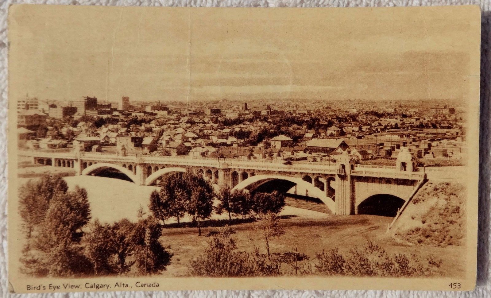
Crescent Heights must have been as popular a vantage point way back in the day as it is today. This particular photo was taken from what looks like today’s Rotary Park area, with the source saying it’s from 1938.
This clearly shows that Memorial Drive has been a roadway for a very long time. It also looks like a pedestrian walkway underneath Centre Street Bridge.
Factory Section, East Calgary – 1920s
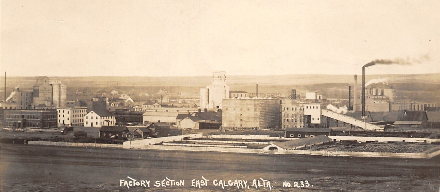
What looks like the beginning of the Victoria Park area came to fruition in the early 1920s. Once again, we can see the plateau that runs north along the Bow River, just north of our city's current downtown, on the horizon.
Centre Street Bridge & Downtown – 1943
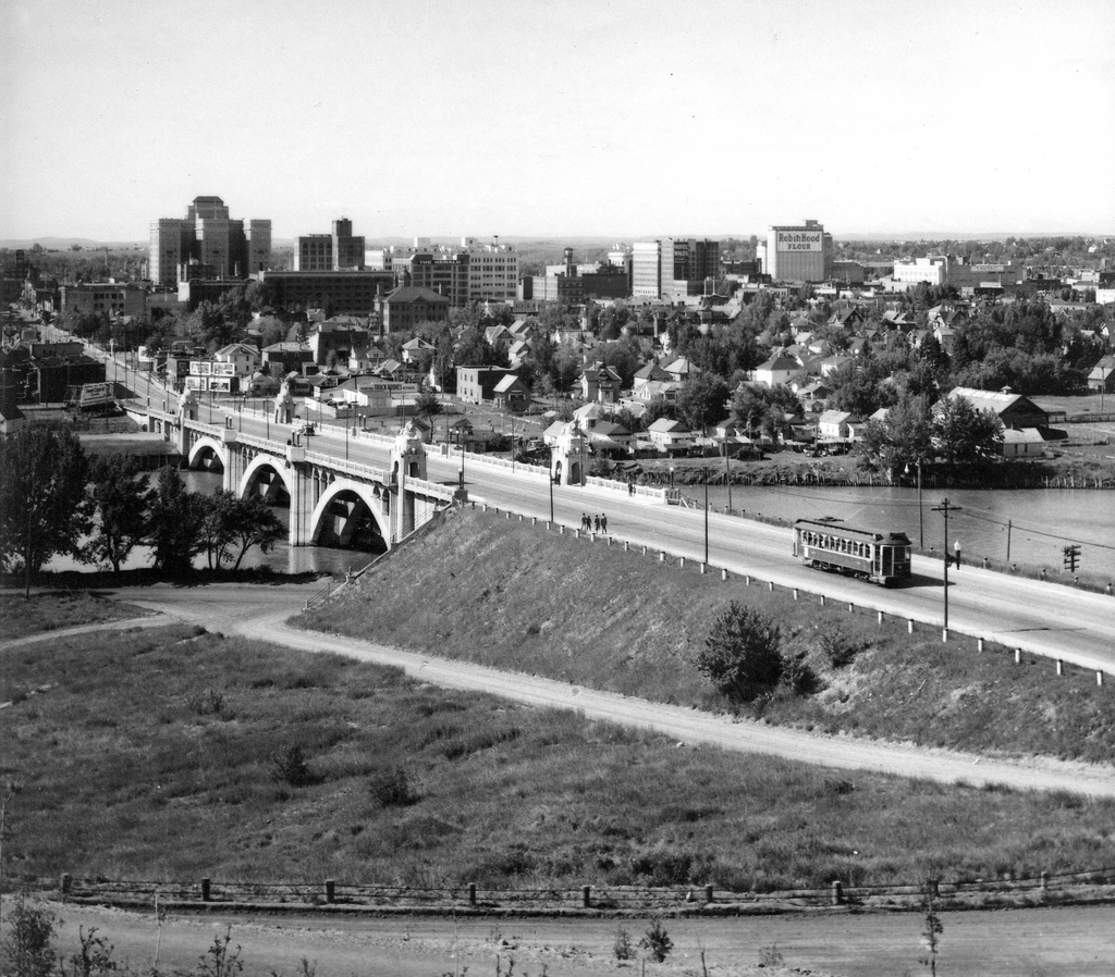
Amid World War Two, Calgary was now bustling with its first few tall structures already protruding on the horizon, including the Fairmont Palliser Hotel (the tallest building on the left).
Notice the dirt roads and prime real estate in what is now known as Chinatown that’s been filled to the brim with mid and highrise buildings.
Knox United Church - Early 1900s
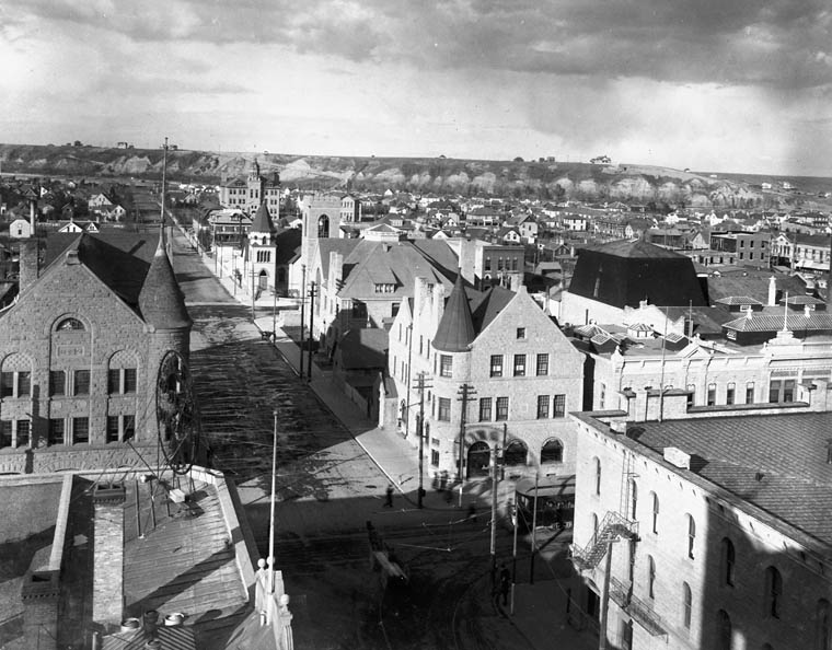
Notice the beautiful and old Knox United Church standing tall on the next street down at the intersection. This structure was made out of sandstone, as were many of the other buildings in the picture, as a result of a motion by the city council to build with fire-retardant material (the Great Fire of 1886).
The sandstone was mined from the banks of the Bow River and is still seen in old historical buildings in the downtown area today.
Stephen Avenue Looking East – 1928
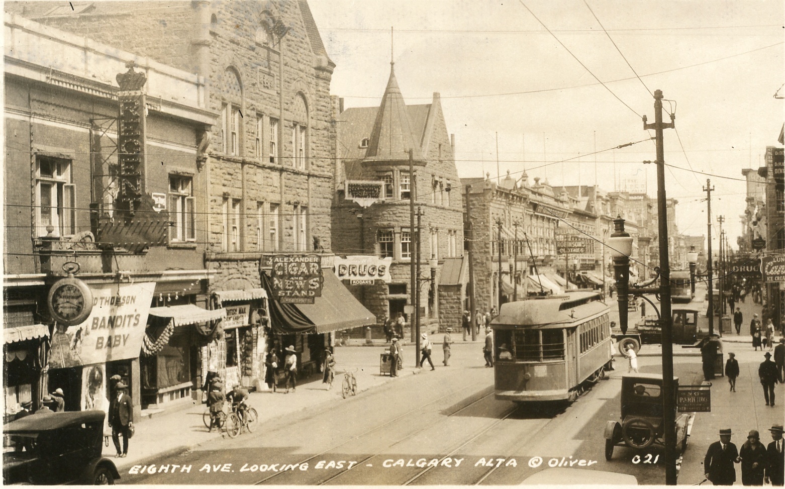
Stephen Avenue seemed to be livelier than it is today. Okay, maybe that’s not possible given that this was way back when the city wasn’t many decades old. But at least you could hitch a ride on a railcar instead of having to walk from one end to the other.
Notice the sandstone buildings once again, which make these historic pictures of Calgary quite picturesque.
First Street West – 1928
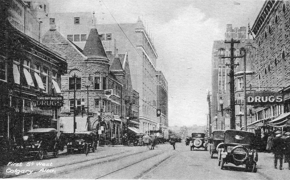
Another look at downtown in 1928, this time First Street West. Today this street is in the heart of the downtown business core and spans from east to west for several blocks. It seems Stephen Avenue was a centre for business back then too with the larger buildings towering over the smaller sandstone ones.
Notice the railcar tracks and more sandstone construction. Once again, some of these buildings in downtown still stand today.
Streetcar Northbound on First Street - 1909 - 1910
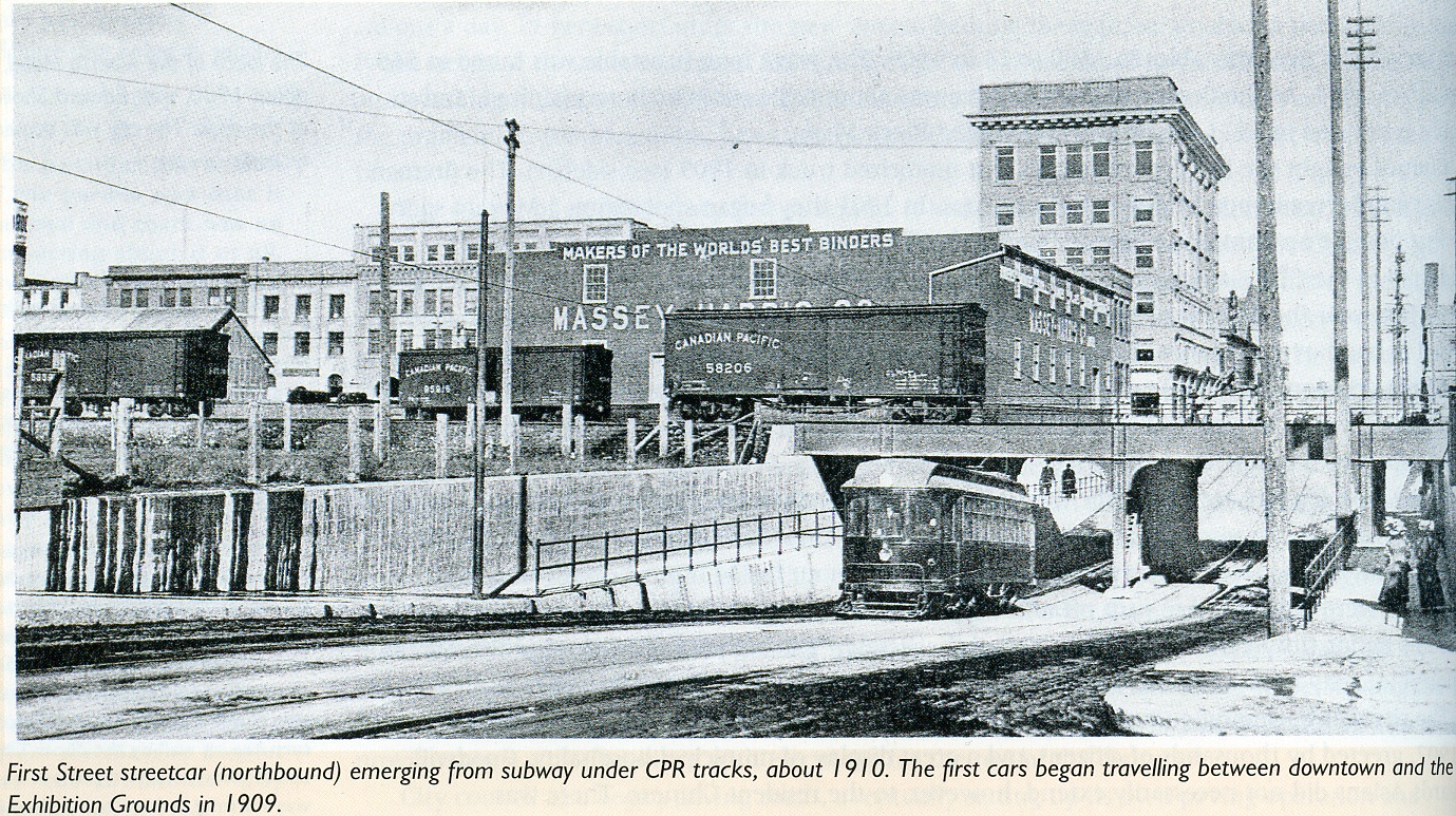
The little duck down under the railway between 9th and 10th Avenue downtown is shown in its early years in this historical picture of Calgary.
While some of these underpasses are now renovated, there’s not much that looks different from today.
Stephen Avenue Looking West from Centre Street
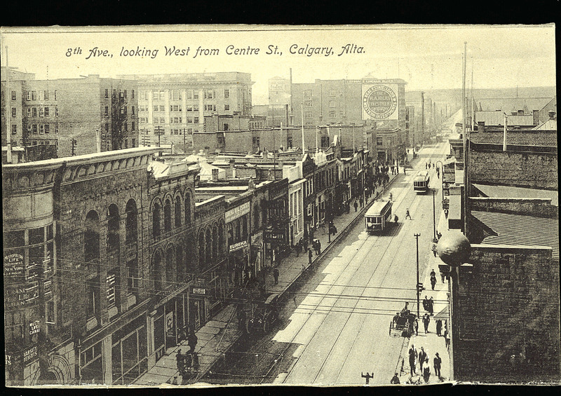
Another classic photo of 8th Avenue SW looking westward. In the distance, you can see the foothills that would today be either the communities of Sunalta or Shaganappi. We’re guessing this photo was taken sometime in the early 1900s
Downtown Streetscape in Colour
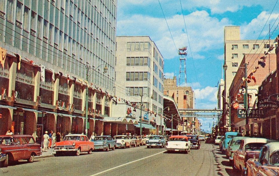
Judging by the cars and colour in this historic photo of Calgary, we’re guessing this was somewhere downtown – maybe even Stephen Avenue – in the 1950s or 1960s.
Notice the walkway between the streets in the back, which looks like a pedestrian walkway but much higher than a +15.
Beginnings of Chinatown – 1950s
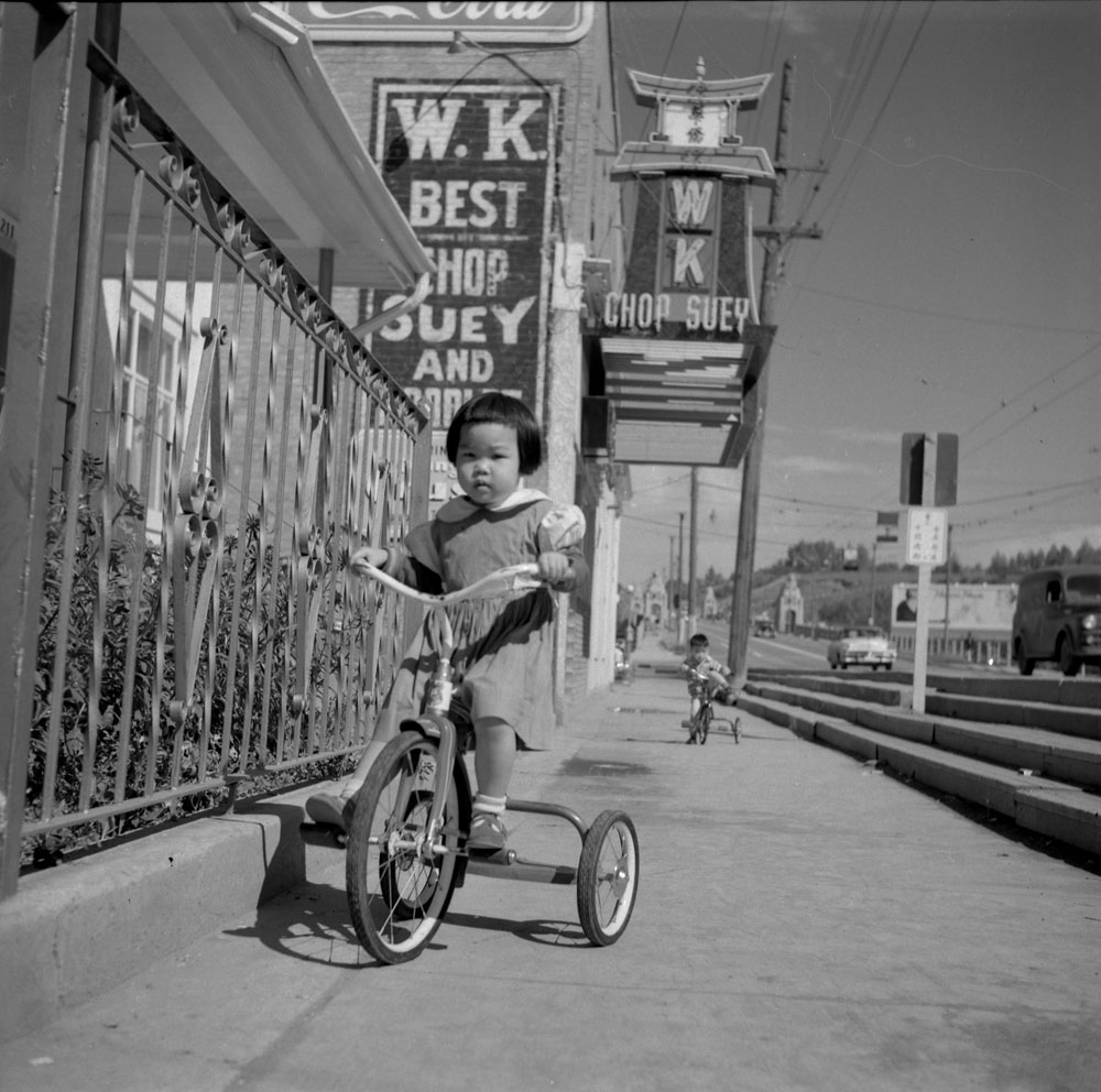
Chinatown, right on Centre Street in downtown Calgary. In the background, you can see Centre Street Bridge's quad lion statues.
Wild West Town – 1886
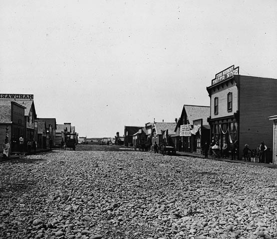
According to this historical photo of Calgary, it took only a decade or so for the settlement to develop a main street that looks like it’s right out of a wild west cowboy movie.
We can only imagine what life was like back then for people in the city… okay, maybe we can, and I think we can all agree on that we would prefer the life we have today!
Chinatown - 1965
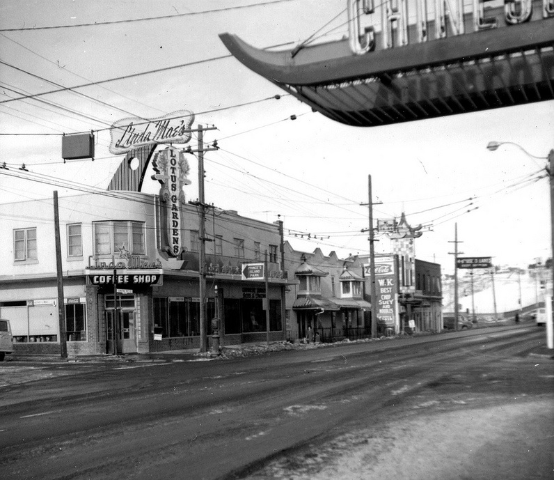
Most of these buildings have been removed, save the one in the centre right, which we believe has just been renovated over the years (the sign still stands). Notice the house on the hill in the background, an area known today as Crescent Heights.
Compared to older photos of Calgary, it looks like residential development became a lot more rampant on the hill to the north of downtown as the years passed.
Knox United Church
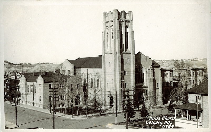
Another epic photo shows a building that still stands today in Calgary. Notice how there are more homes on the hill in the back, which leads us to believe that this historical picture of Calgary was taken sometime in the early 1900s.
Church of the Redeemer
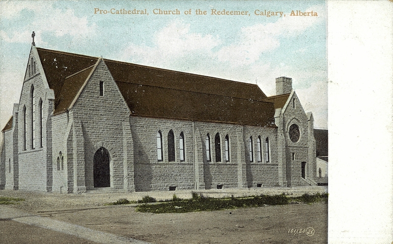
If you’ve ever taken a stroll downtown on 7th Avenue and 1st Street SE, you’ll notice this church still standing with its beige sandstone brick and red tile roof. The photo itself is colour, so we think it was taken sometime in the 1950s, although dirt roads would suggest much earlier than that – sometime in the early 1900s.
The Church of the Redeemer was built in 1905, so it’s possible this photo just had colour added to it after being taken in the 1900s.
Palliser Hotel and Canadian Pacific Railway Depot
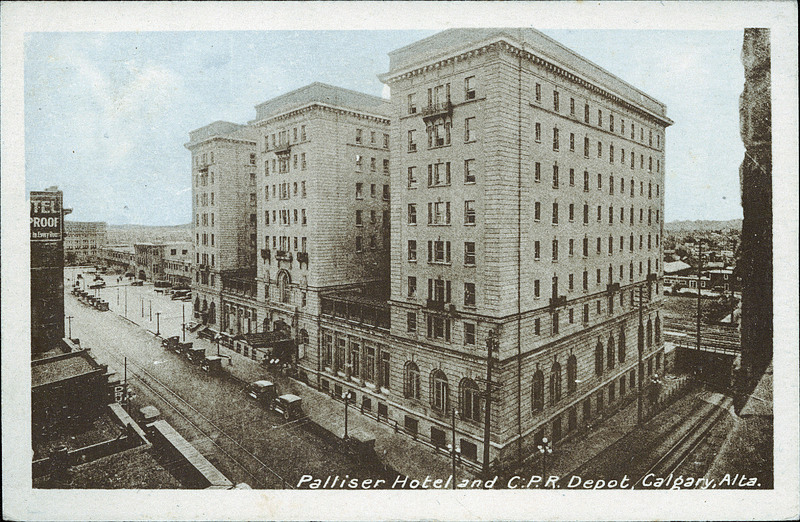
The Fairmont Palliser was built in 1914 and was the tallest building in the city for many years. During its lifespan, it also underwent multiple renovations that added more floors, but we can tell this photo was taken with none yet performed.
Notice the paved streets and slouching ramp that dips at 1st Street SW and turns into a tiny hill in front of the Palliser Hotel. If you drive downtown, you’ll agree that this little feature of the roadway still exists today.
King Edward Hotel in East Village
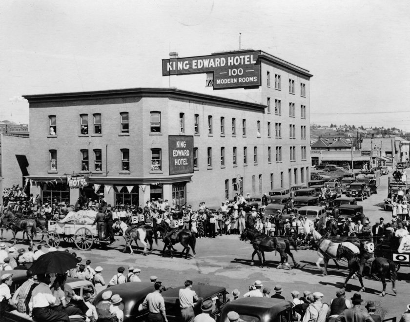
We’re pretty sure it may have been called “East Calgary” at the time, but here’s a shot of the King Edward Hotel in East Village in some time in the late 1910s or 1920s. We’re guessing the age of the photo by the style of the car in the picture, which is in line with what you would see in the 1920s.
The King Edward Hotel was founded in 1905 and still stands today. The City of Calgary has designated it as a historic building and has been restored to keep it standing and functional as a place of business.
Fire Headquarters in Downtown
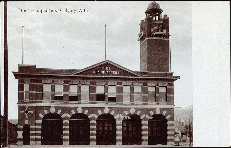
Driving westbound on 6th Avenue SW downtown you’ll notice this antiquated Fire Headquarters still standing on the corner of 1st Street SE. A huge difference from way back then and now will be the view of the Bow Tower which was completed in 2012 and stands as one of Calgary’s tallest skyscrapers.
Today you’ll notice a few renovations on the building in comparison with this picture, but most of it stands unchanged. Incredible!
I Love Calgary!
Do you love Calgary and its history as much as we do? If so, we invite you to join us at Calgaryism on Facebook and Instagram to stay up-to-date on local activities, events and projects happening in and around our city. We are looking forward to seeing you there!
Image Sources: Prairie-Towns.com
